Product Information
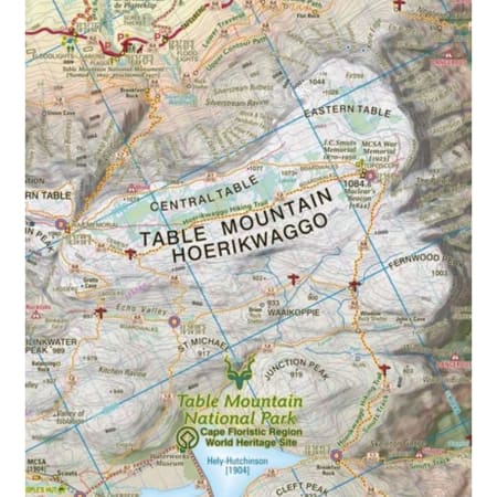
This highly detailed map shows all approved paths on the mountain and includes full GPS information. The map shows the Hoerikwaggo and the Peoples Trail, and covers the area from Signal Hill to Devils Peak and Llandudno to Constantia Nek and the Vlakkenberg Plateau. This is the only map of the mountain endorsed by the Table Mountain National Park, and approved by the Mountain Club of South Africa.
- Distances and estimated times shown for all paths above the Contour Path or Pipe Track
- Long/Lat grid at 10" intervals as well as the 200 metre square UTM grid; Completely revised vegetation distribution
- Some vanished paths removed; some new ones added
- Three Firs, Oudekraal Ravine and Constantia Corner routes upgraded; Clearer depiction of many features, including dangerous routes
- All approved paths, with DD MM SS GPS coordinates for major junctions
- 10 metre contours & delicate colour height shading bring the topography to life
- Forty quality photos of the most prominent mountain flowers, as well as line sketches of flora and fauna are included on the map
- A sketch of the view from Maclear's Beacon, with names and distances to prominent peaks on the eastern horizon
- Written descriptions of 23 of the most popular routes, with distances and approximate times
- Important safety instructions, emergency telephone numbers, Cableway and National Park details
- A2+ full colour map
- Scale 1:20 000 (5cm = 1km)
- 10m contours; relief shading
- 200m2 UTM grid, WGS84
- 10" Long/Lat grid
- Coords in DDMMSS format at important junctions
- 23 Route descriptions
- Safety information & contact numbers
- WATERPROOF and TEAR RESISTANT in plastic sleeve

